
Editor’s Note: This is part of a series of dispatches from the Knight Science Journalism Program’s 2020-21 Project Fellows.
I first read about the Great Flood of 1862 in the margins of a long list of American ghost towns. I was researching a story about the Tennessee Valley Authority’s procedures for relocating cemeteries — they moved more than 20,000 graves over the course of three decades of dam-building — and I came upon a database of settlements wiped off the map by both natural and manmade floods. Under the heading for California, one date appeared again and again, like a drumbeat: 1862, 1862, 1862, 1862.
The flood that year was the largest in the recorded history of the state, a series of storms that inundated wide expanses of southern, central, and northern California. Edward Everett Ayer, a member of the Union army stationed in what is now Santa Monica, described seeing “water, water everywhere, and little above.” Most of the Central Valley disappeared as the San Joaquin River and its tributaries rose high above their banks. In Sacramento, Governor Leland Stanford had to travel to his inauguration in a rowboat. By the time the rivers finally receded in the spring, a quarter of all the buildings in the state had been destroyed.
Recently I spent a week driving from San Francisco Bay to Sacramento to Los Angeles, tracing the edges of the 1862 floodwaters and trying to imagine what would happen if a similar series of storms hit California today. Mostly, the news is not good: we’ve built homes and schools, shopping malls and factories, warehouses and office parks in the middle of what was, almost 160 years ago, a network of deep, muddy, white-capped lakes. What’s more, recent research indicates that extreme storms like the ones responsible for the 1862 flood are becoming likelier as the climate warms.
Before I set out on my trip, I decided to add a few stops to my itinerary that would bring me back to that first eerie encounter with the Great Flood: the towns that had disappeared after the waters rushed through. After all, the destruction of 1862 wasn’t an anomaly; it was a harbinger. In the past century we’ve sacrificed neighborhoods to highway expansions, made communities unlivable with pollution, and abandoned cities due to radioactive contamination. I wanted to see what was left behind after a disaster — but how do you go about finding a place that vanished so long ago?
One lead came from the January 19, 1862, edition of the Daily Alta California, a newspaper published in San Francisco. The paper reported that a man named George Emerson had just returned from Mokelumne City, which stood at the confluence of the Mokelumne and Cosumnes Rivers and was once the second-largest town in San Joaquin County. “Mokelumne City was nine feet under water,” Emerson told the newspaper, and a hundred women and children “had taken refuge in the ball room in the second story of Keith’s Hotel.” Eventually everything but Keith’s Hotel — twenty-three houses, several stores, another hotel, and a warehouse — was carried off by the rivers. The town was never rebuilt.
Recent research indicates that extreme storms like the ones responsible for the 1862 flood are becoming likelier as the climate warms.
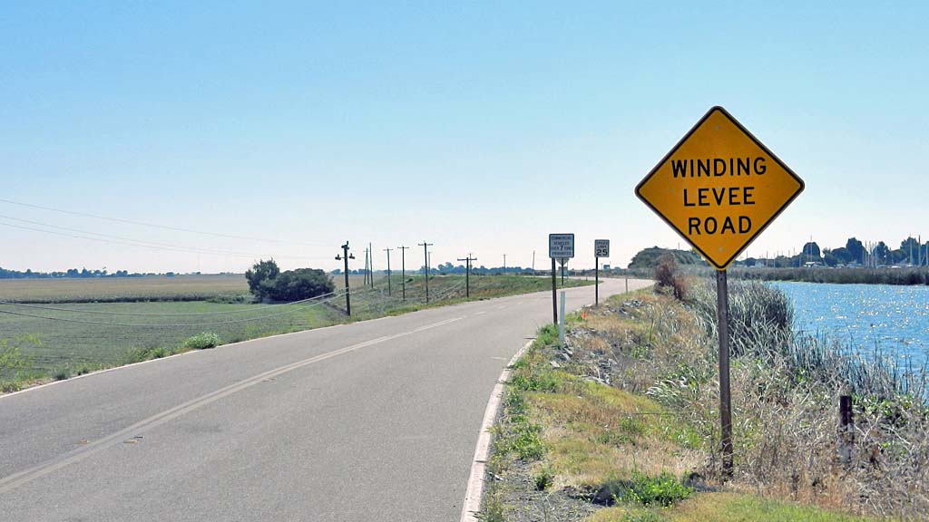
Supposedly, there was a historic marker where Mokelumne City once stood, a few hundred feet from a bridge over the Mokelumne River. I drove northeast from San Francisco Bay, crossing the San Joaquin on a giant span near the town of Antioch. Below me I could see the Sacramento–San Joaquin River Delta, an immense flatland of farms, walnut groves, and irrigation ditches, all protected from the rivers by a network of levees. The road to Mokelumne City runs on the top of the levee holding back the Sacramento River. Driving upriver, the roofs of the farmhouses reached up to the height of my hubcaps.
A few miles east of a town called Walnut Grove, I arrived at the intersection of two farm roads and saw a three-foot-tall granite block set next to a paved turnout. According to state records, a plaque placed on the stone in 1935 once read: “Established in 1850, its prospects were bright. The second largest town in the county, it had deep water communication with San Francisco all year round, an advantage not possessed by any other town in the county except Stockton. The floods of 1862 destroyed the town.” Now the plaque, too, was gone.
I walked to the bridge. Nearby was an ancient-looking barn: it was built, reportedly, from the remains of Keith’s Hotel. At the river, I saw two squat levees extending along its banks, the only protection for the farms here from a future flood. The water below rolled by placidly; it was hard to imagine it turning into something that could erase a village.
A week later, almost four hundred miles south, I found myself high in the San Gabriel Mountains above Los Angeles, near the confluence of the San Gabriel River and a small tributary called Cattle Creek. The flood had hit here, too, a few days after Mokelumne City had been destroyed. Ayer, the Union soldier, said there was a week of solid rain, after which the streams from the mountains all turned into torrents. “It absolutely tore southern California to pieces,” he wrote.
Cattle Creek had been the site of a gold-mining camp called Eldoradoville. As many as 2,000 men and women lived there, until the flood came for them as well. The only way to survive the torrent was to scramble up the side of the hill and watch as the waters carried everything away.
When I visited, the San Gabriel River and Cattle Creek were barely flowing at all. Tents dotted the gravel bars for miles up the canyon; what was a pleasant place for a camp in 1862 is still a pleasant place now, as long as the rains hold off. There was no evidence of any of the structures that stood here, briefly, in the nineteenth century, but I did catch a few modern-day prospectors sluicing, illegally, for gold.
During the rest of my fieldwork in California, I saw fast-growing cities and massive dams and brand-new neighborhoods built right up against rivers that have flooded, catastrophically, many times before — though not recently enough to stop the developers from moving in with plans for a new subdivision. But the two most memorable moments of my trip came in the silence of those two non-places. Eldoradoville and Mokelumne City: they’re not the only towns we’ve lost, or will lose.
Christopher Cox is the author of The Deadline Effect, which will be published on July 6 by Avid Reader Books. He has written for The New York Times Magazine, Wired, Harper’s, and Slate.

Hello Mr. Cox,
I enjoyed the subject of this speculative article. There is real potential for devastation, especially with climate change increasing the extremity and unpredictability of weather events worldwide. Recent wildfires in the Sierras might also increase the likelihood of flooding events downriver.
My main concern is an important historical component you left out in your foreboding report.
In your research, did you not come across anything mentioning that the flooding events of the 1860’s were due in large part to hydraulic mining activity in the foothills? Hydraulic mining of the scale that was occurring in the 1860’s created huge amounts of debris (“slickens”) that inevitably found its way into the main waterways and collected in the lower reaches of the Central Valley. Many towns were flooded, eventually leading to the Sawyer Decision in 1884, which revealed the growing importance of agriculture in CA.
While mass flooding is still possible (indeed, likely) in the Central Valley in years to come, mining activity was an important factor in the level of devastation seen in the floods of the 1860’s.
This is not correct. Hydraulic mining debris in the 1862 flood was minor compared to the magnitude of the flood. Also debris impacts were localized, mainly on the Feather and Yuba. Hydraulic Mining in 1862 was not as widespread and sophisticated as it would become after 1862. Still heavy rain is always the driver of large floods – but other factors can enhance the flood peak or volume. Climate change will produce bigger rainfall than we’ve seen in the past, in the next 50 years
Fun article, nice job, but this was a series of big storms – from OR to NorCal to SoCal , Dec – Jan , occasionally pushing inland